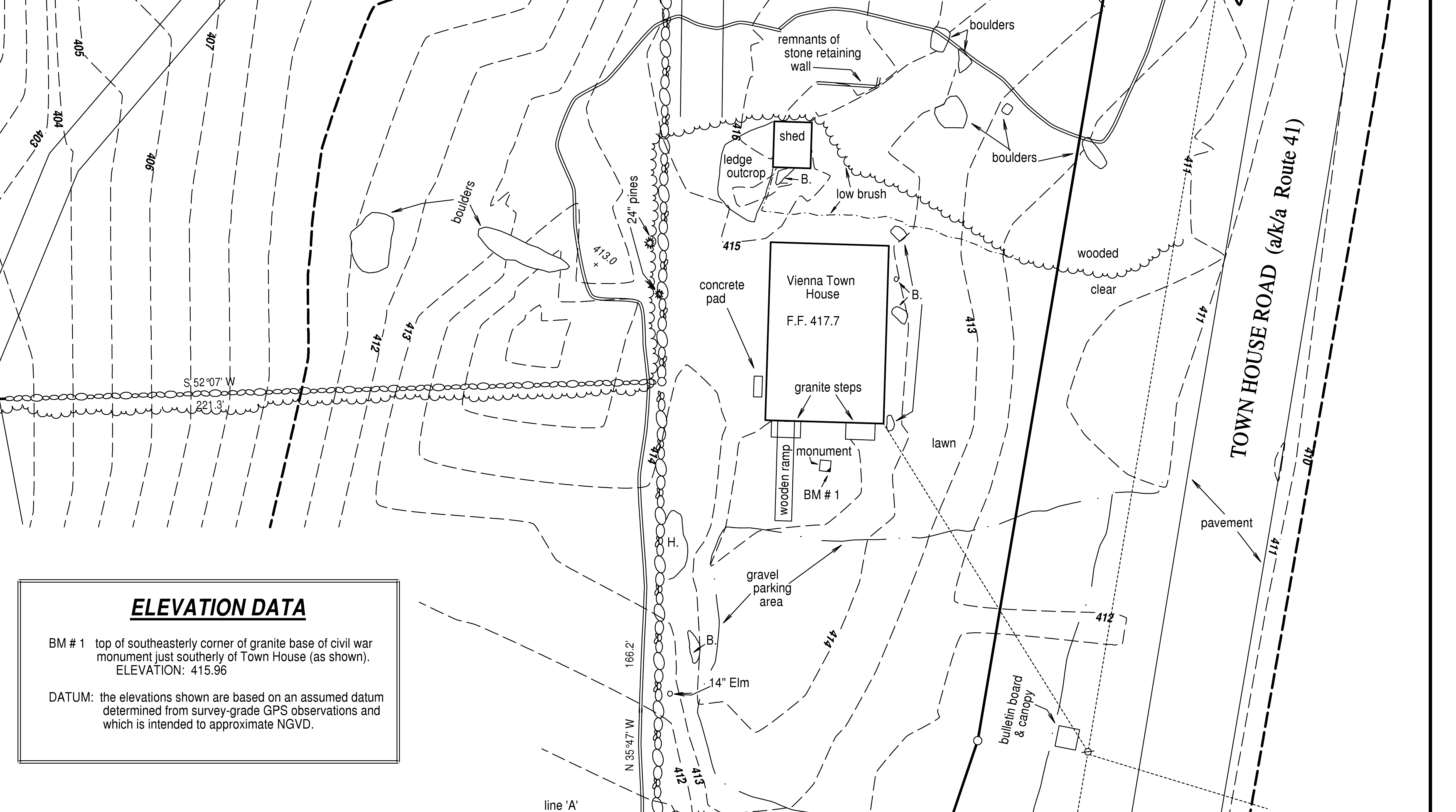
“Topo” surveys are normally only used for architectural or engineering purposes, usually being completed prior to structure design. Following extensive field work a map will be produced showing elevations (usually by showing contours) and such features as are deemed necessary for the project at hand (though existing structures, roads, and major watercourses are almost always shown).
“Topo” surveys are normally only used for architectural or engineering purposes, usually being completed prior to structure design. Following extensive field work a map will be produced showing elevations (usually by showing contours) and such features as are deemed necessary for the project at hand (though existing structures, roads, and major watercourses are almost always shown).